
DE.MARCATION

Great cities are not always measured by how good they are planned, but by how well their plans anticipate change and growth over time. DE.MARCATION envisions RNK (near Kalmar, Sweden) as a future town, and uses the means and methods of measurement and property ownership as a generative system for urban growth and development. The city is organized within an urban structure, that not only equally distributes and diversifies the land and lad-use, but also serves as an infrastructural system that could extend the city as it grows.

Step 1: The Mother Grid
In the first step, the existing railroad running through RNK is used as a base line for a grid of 150m by 150m running on both direction. This grid divides the land into parcels of equal size, and with that forms the city’s primary infrastructural grid. We call this system “the mother grid.”
Step 2: The Markers
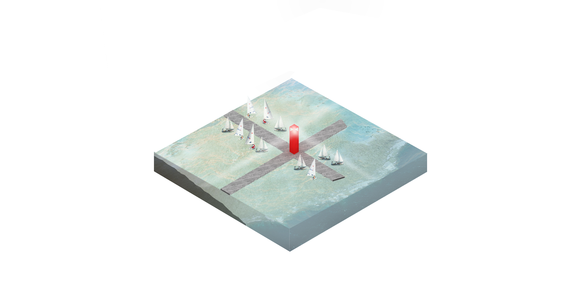
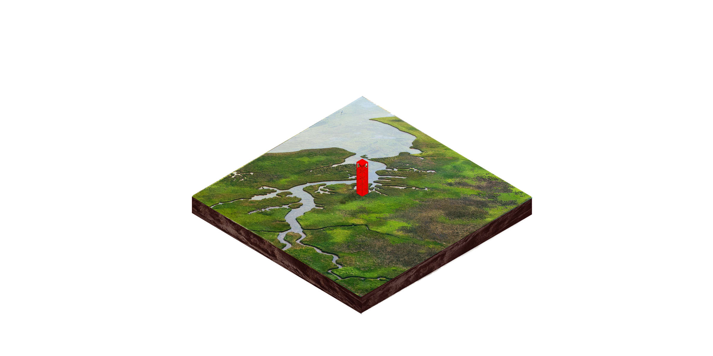
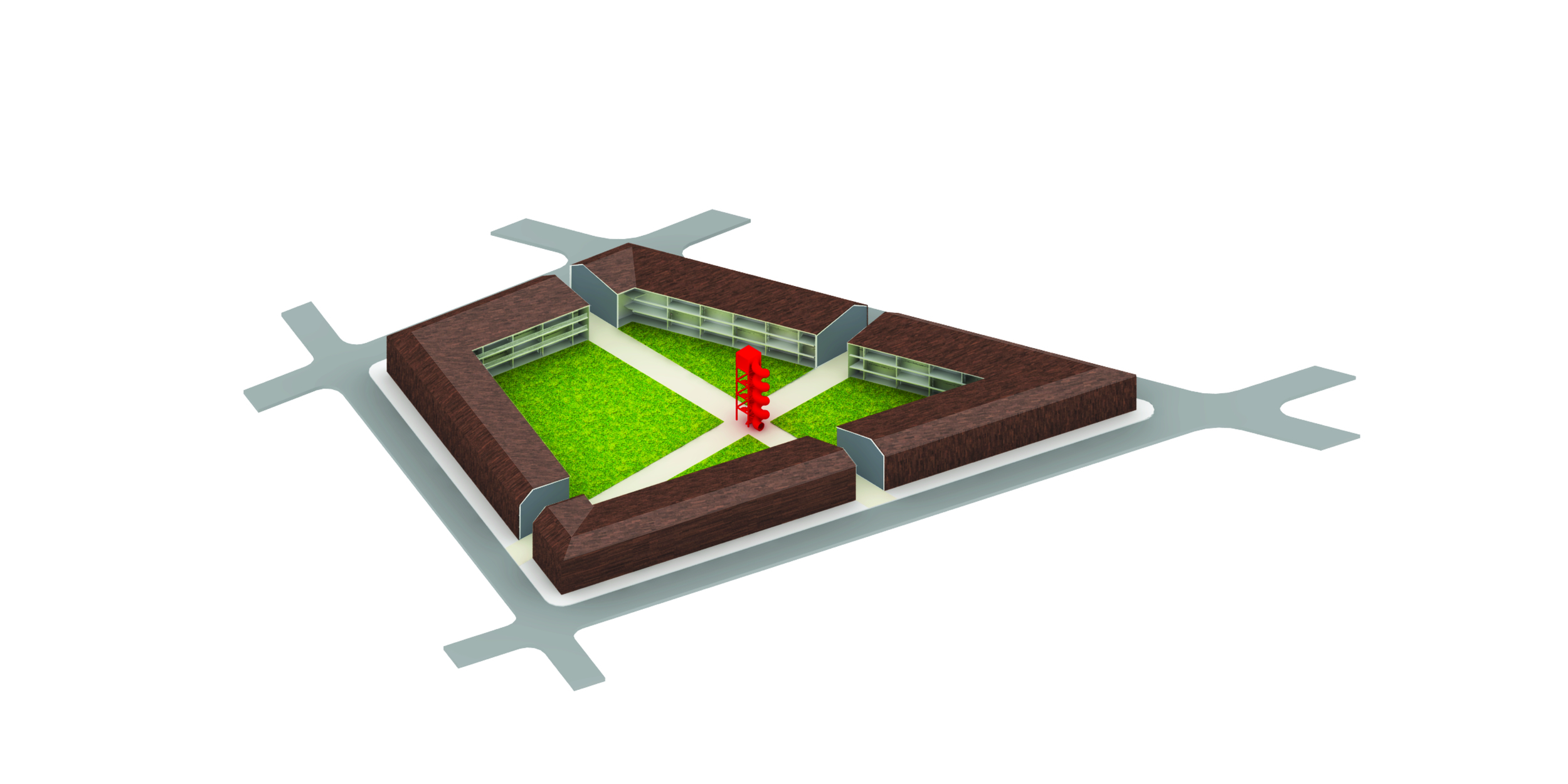
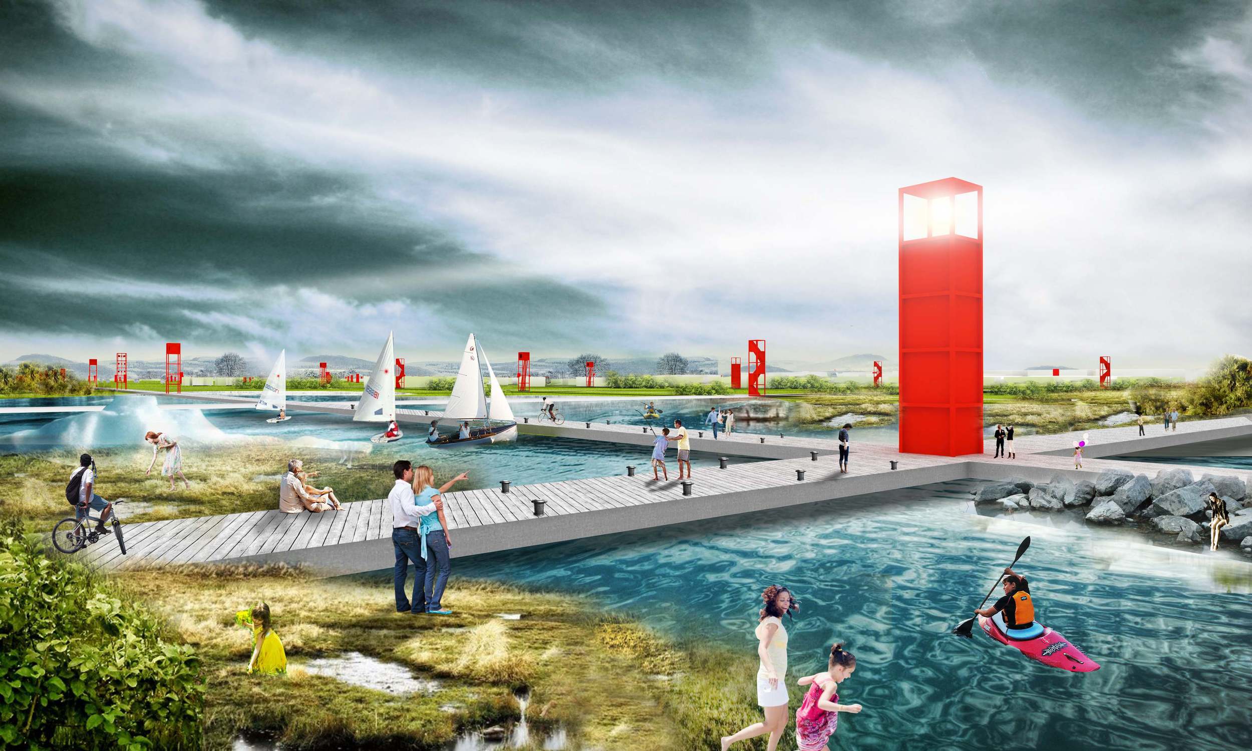
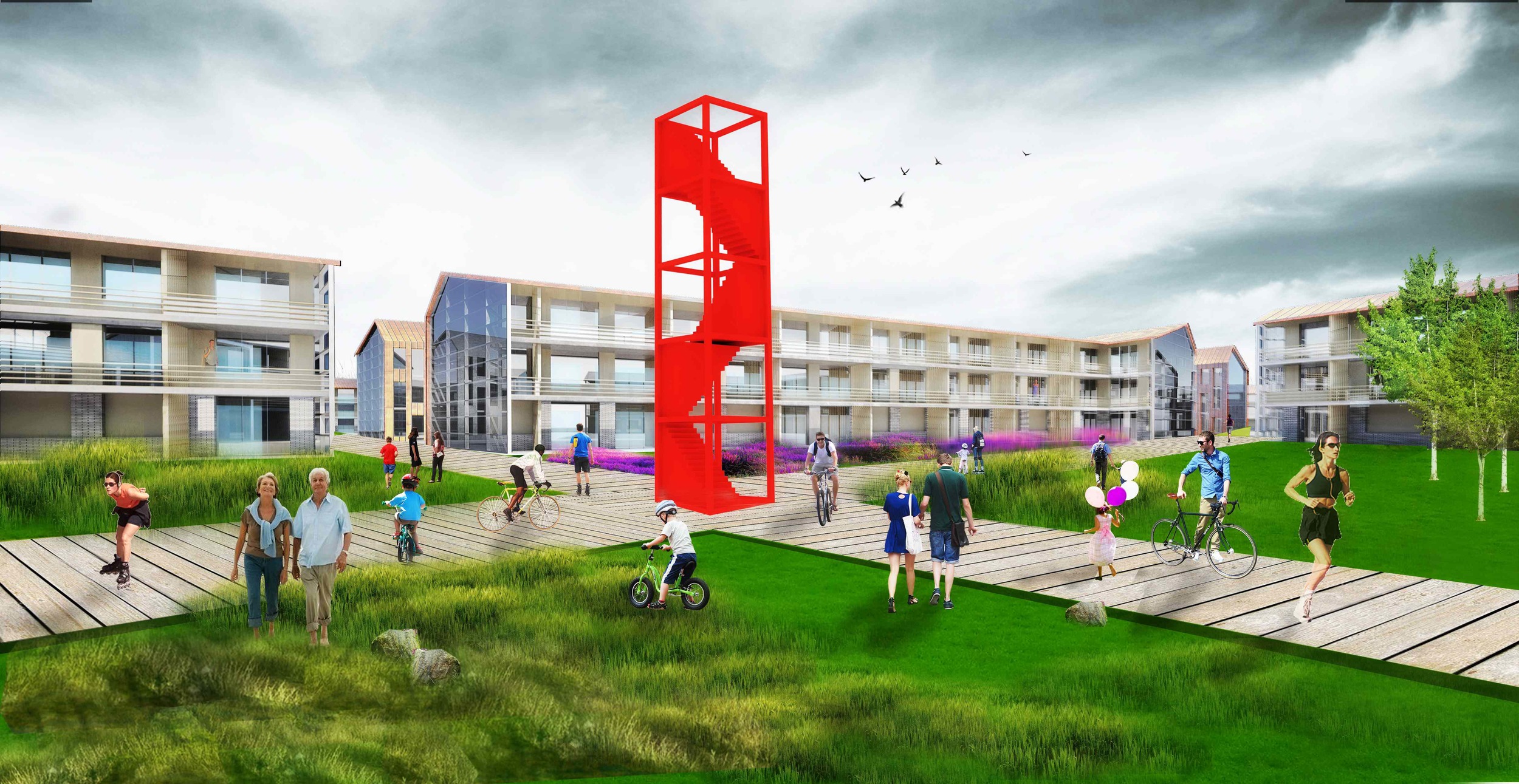
We mark the intersections of this grid with a series 20m tall structures called “the Markers.” The Markers mark the territory, both in plan defining the corners of every parcel, and also in section as the ground/ landscape shifts over time and the sea level rises. The Markers’ function and role differs in different areas of the town from being a clock tower in the civic center, a slide in the school courtyard, to a lighthouse in the marina. Once the land is marked, the makers serve as a permanent record that indicate where the ground is currently present and could be taken by the water.

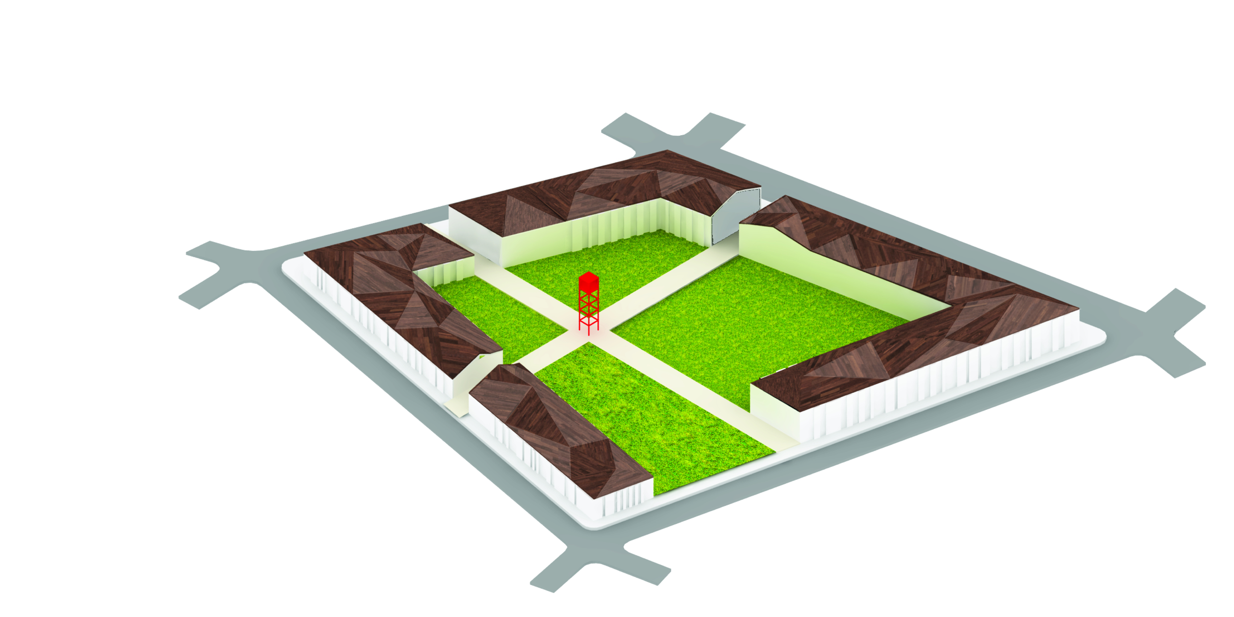
Step 3: The RNK blocks
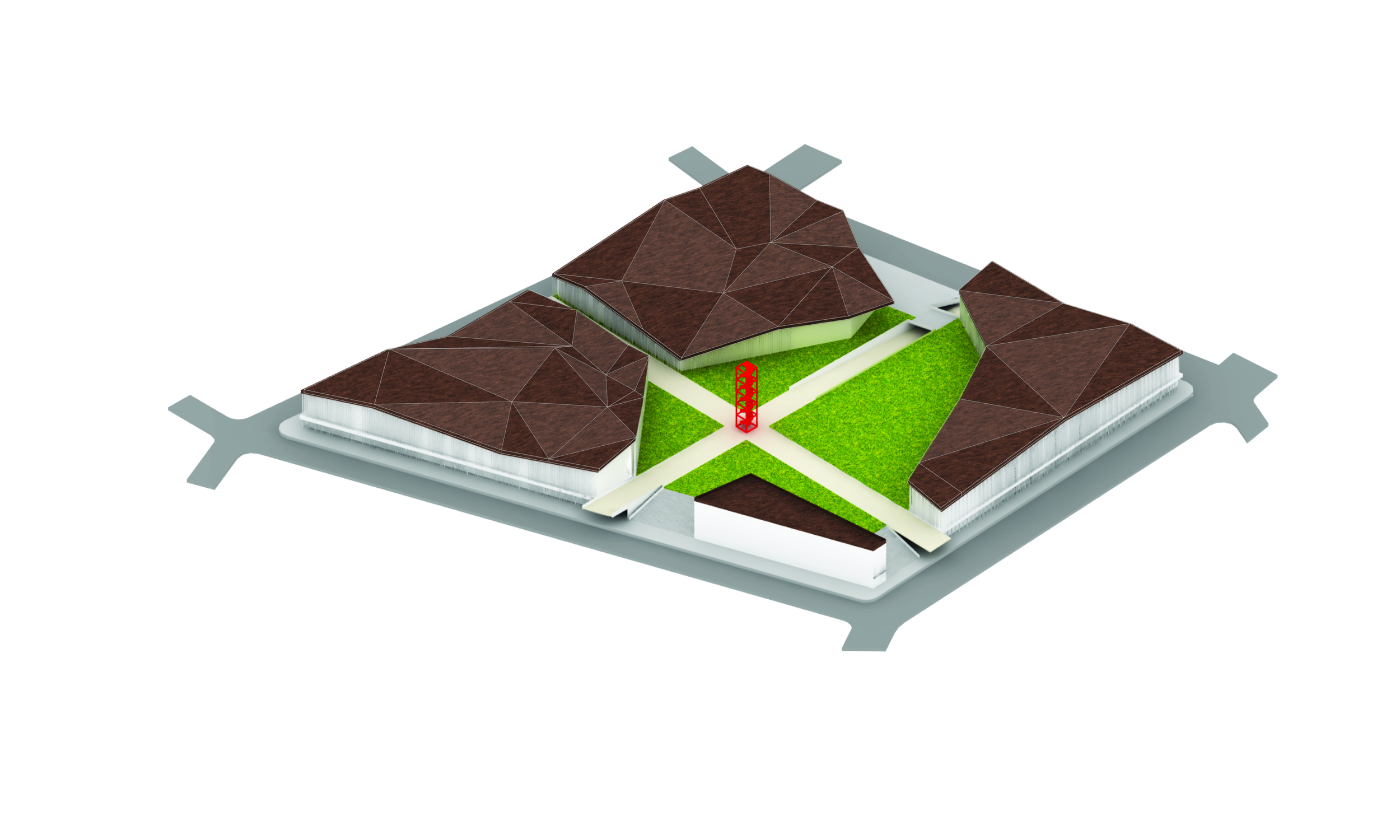
The new streets run in between the Mother grid, and therefore divide the land parcels. They also connect to the existing streets and E-22 already in place in RNK. The streets form a secondary grid (a topographic grid as opposed to Mother grid’s orthographic system). The non-linear system of the street help regulate traffic speed and create more interesting street and driving experience through the town as well as adapt to the existing street configuration. Although the divisions of the parcel are not equal, each land parcel at the end contains 4 quarters with the total area that would be the same. While the streets divide the parcels, they form a secondary grid system with new (irregular) block of different forms, sizes, and shapes which would contain different program and use allowing for various block morphologies. Each block would then contain 4 quarters from different land parcels with potentially different ownership or use, which would in turn foster diversity of building types, use, or occupancy within each block. The owners are to build around the blocks with buildings facing a large interior public space inward, and the streets outwards. The depth of the buildings change with their program and use of that block, allowing for infinite variations within the system. Each block would also house a Marker sitting at the center of the public space, that functions differently depending on the use of that particular block.
Step final: the Mother grid
Once the land parcels, the streets, and the block, and the building are in place, the Mother grid emerges as a pedestrian network of 8-meter wide paths that cut the buildings and connect the markers. This creates a pedestrian network that connects the public spaces with the city, and could potentially extend that to new developments.
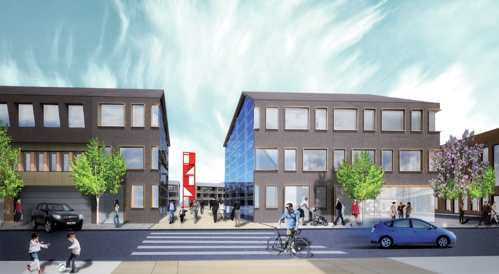
In the proposed plan, E-22 is used as the city’s new Main street with mainly commercial program at the ground level. De.marcation also envisions a “Marina boulevard” that runs perpendicular to the Main street, beginning with the existing town, running across the Main street through the proposed development and finally ending at the Marina. The civic buildings as well as the school, the community center and the library are are envisioned at the intersection of Main street and Marina boulevard. Higher density residential blocks are closer to the town center while lower density blocks are on the peripheries.

The dynamic block and road design allows for a variation of housing types and forms. At the urban core the blocks are courtyards, enabling private outdoor space against the building and open greenspace for the public at the center. The housing density decreases as it filters towards the outer portion of the master plan, introducing U and L shaped buildings, decreased height, and eventually detached residences at the fringe.
At the intersection of the MOTHER GRID and the architecture, the buildings are sliced to create a third condition. The building section is exposed by glass and the viewer perceives the street facade becoming the roof plane in that moment of encounter. The community effectively wraps and shelters the residential architecture. The roof ends as a thin line gesturing towards the inner courtyard open space.
The block design is easily suited for the variety of building types and functions required by the community. The MOTHER GRID intersects these blocks in a similar manner to the residential blocks providing continuity of community character. The buildings themselves can expand or contract depending on program. The adjacency and linked spaces create a highly flexible use from program to program and block to block. This vitality embraces and encourages interconnectivity of the residents with the adaptable and diverse functions. The courtyards are raised plazas, providing for centrally located street lined retail and ground level parking at the town’s central area.
Project in collaboration with Ryan Lobello
Honorable Mention in Rethinking the Future Sustainability Awards, Urban Design Category 2014.